
Weather routing software
Take a deep-dive into intricate weather routing with onboard computer software
For years sailors were mostly left to call on experience and instinct when it came to routing a passage. Today, onboard computing power relying on copious amounts of data can show sailors any route with any number of variables applied.
Routing goes well beyond just plotting a course. Instead it takes into account predicted weather, currents, a boat’s performance characteristics, whether the boat is sailing or powering and numerous other factors. Several different companies offer weather routing software, although the amount of factors and available options as well as required equipment varies widely.
There are several app-based options, including Avalon Offshore Weather Routing (see more about this app on page 45) and PredictWind, which are ideal for sailors looking for easy-to-operate routing software at a low price. The specifics of the routing are somewhat limited to performance characteristics of similar boats (you have to choose from a list of boats and if yours isn’t among those listed, you need to choose the model closest to what you’re sailing), but these have the convenience of running on tablets or smartphones.
The step up comes in the form of computer software running on an onboard computer. There are multiple players at this level, but among the most feature-rich is Expedition Marine, which was developed by Volvo Ocean Race navigator Nick White. Although the program is used by navigators and strategists in the premiere ocean races, it also offers important features that are beneficial to passagemakers as well, including the ability to route for powering in specific conditions, such as when the wind falls below a certain speed.
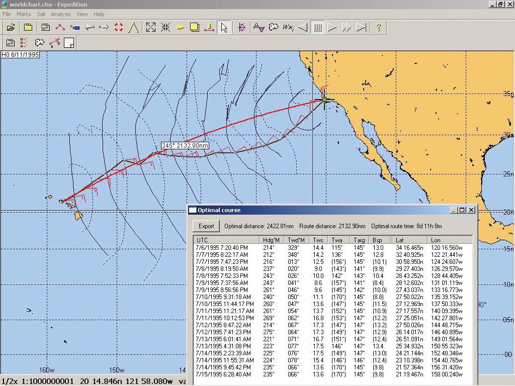
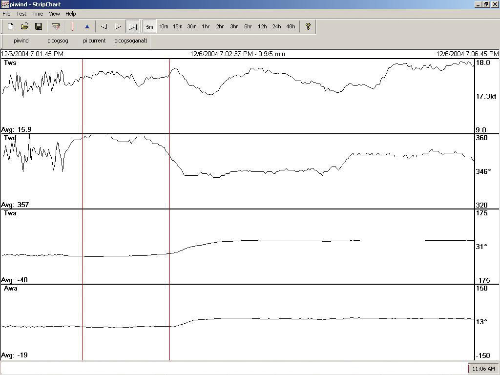
For advanced use, there is almost no limit to the amount of information that can be used to create different routing scenarios in Expedition, which sells for $1,295. Fine tune performance polars, upload a sail chart to aid in sail selection, download multiple GRIB files from various models to see how a route plays out depending which model is favored and overlay a chart and route with AIS information and radar. A function called strip chart tracks your performance, showing speed, heel angle, heading, wind angle and more from tack to tack. Fine tune laylines and starts by pinging marks.
In fact, there is so much information available through the powerful program that there is a real threat of having too much of it. Wise sailors will remember to keep their head out of the computer and sail the boat and judge conditions for themselves.
While there is much information to be garnered from the program, is it is not necessarily intuitive. Learning the basics of Expedition is not difficult, but taking the program to the next level requires learning and practice. The learning comes from tutorials and webinars—both paid and free through the website or the Facebook page, and often presented by professional navigator Peter Isler—but the practice comes from time on the program. Users need to know their way around a computer, as file management is an important aspect of running the program efficiently.
And of course the program is only as good as the information put into it. Performance polars can be tweaked, as can sail charts and more, but updated weather information is at the heart of routing options. And getting such information requires a cellular signal—obviously limited to a certain proximity to shore—or satellite data, which can become expensive. Racers can also import data from YB Tracking, race tracking used in many high-profile events, to show the location and speed of competitors. Of course you’ll also need a laptop running Windows operating software that meets the program’s requirements. Instruments, GPS and radar information then feeds into the program. Updates are frequently issued, so users need to make sure they are running the most recent version.
Perhaps the greatest value of the program comes in the planning stages of a passage. Running routes for several days before a passage using information from multiple weather models, can help show how models agree or disagree, and how the models change in comparison to one another in the lead-up to a passage. This helps sailors gain a better understanding of the weather picture and how it affects the strategy for the fastest or smoothest passage. Departure planning functions can help choose the best weather window for a passage if the timing is flexible. Even if updated weather data is not available during a passage, sailors will be armed with information about what the weather is likely to do and how that affects decision making.
RESOURCES
Expedition Marine, www.expeditionmarine.com
Avalon Offshore, www.avalon-routing.com
PredictWind, www.predictwind.com (routing via Predict Wind is also incorporated into some B&G chartplotters)
Comments