
Sailing into no man's land
A solo sailor brings his trailersailer north to Ontario, where the solitude and the sailing reign supreme
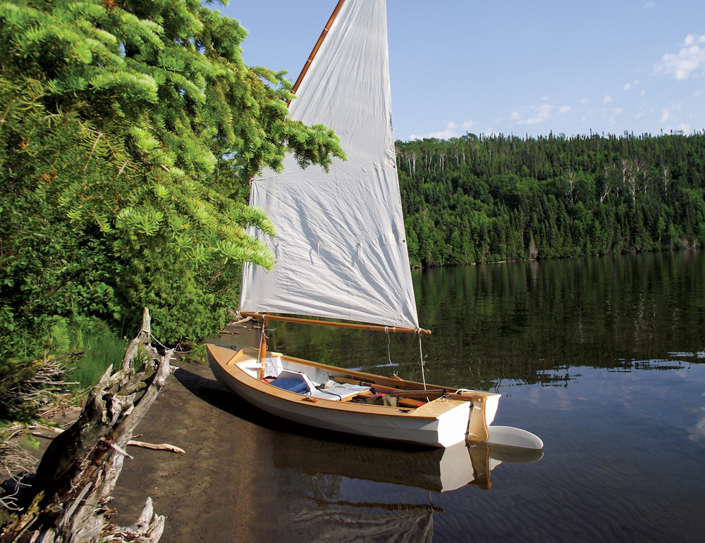
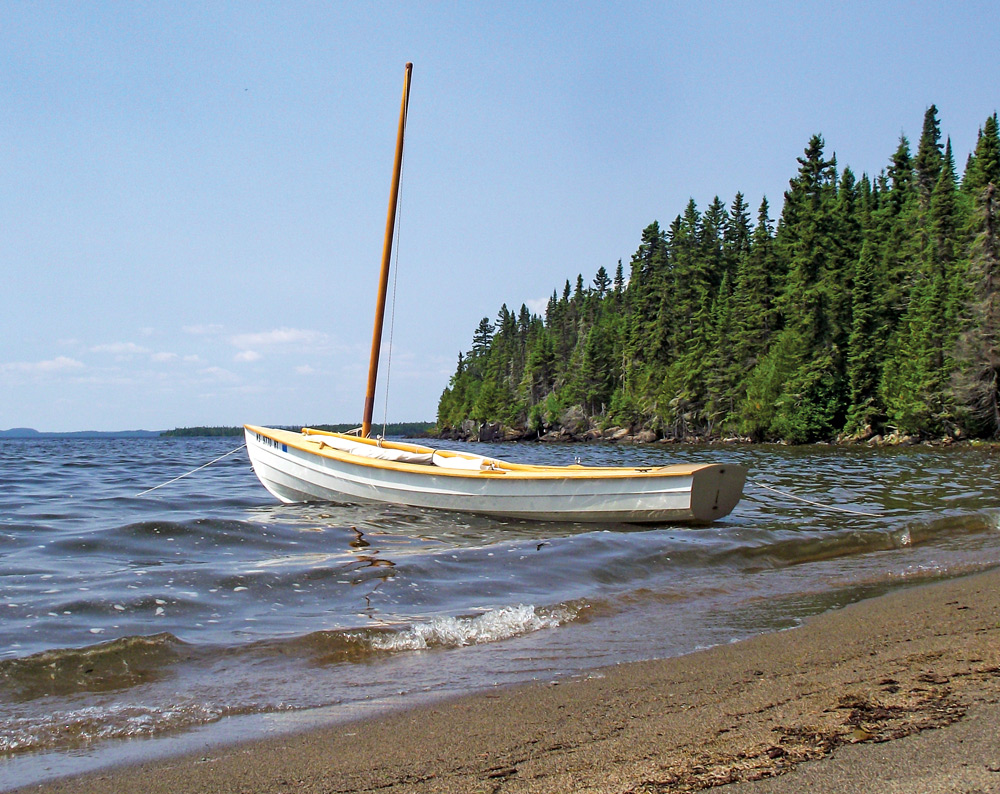
I discovered Lake Nipigon, Ontario, Canada, while thumbing idly through a road atlas, dreaming of destinations suitable for the unballasted dinghy cruiser I had borrowed from my brother for the summer. I wanted a boat that would be light enough to pull up on a beach for camping ashore, but could accommodate sleeping aboard at anchor if necessary. It would have to row as well as it sailed, avoiding the fuss and expense of an engine that I wouldn’t know how to repair or maintain. Most importantly, I needed a boat that could be towed from adventure to adventure by a moderately rundown two-door hatchback. My brother’s boat fit the bill perfectly—a 15-foot plywood-epoxy beach cruiser he had built in his garage, using plans from Australian boat designer Ross Lillistone.
The map itself was delightfully vague. There were no depths, no markings for latitude or longitude, no compass rose or declination and no contour lines. This map is illustrative only, a note at the bottom stated. Do not rely on this map for navigational purposes, nor as a precise indicator routes or location of features. I wouldn’t have been surprised to find “Hic sunt dracones” scrawled across the edge of the page: Here be dragons.

Another sailor might have had everything planned ahead of time, reservations made and permits in hand. Not me. I launched the boat, rigged a tarp on a line between the mast and rudder head for a makeshift tent and slept aboard at the dock, hoping the place would prove to be as ill-patrolled as it seemed.
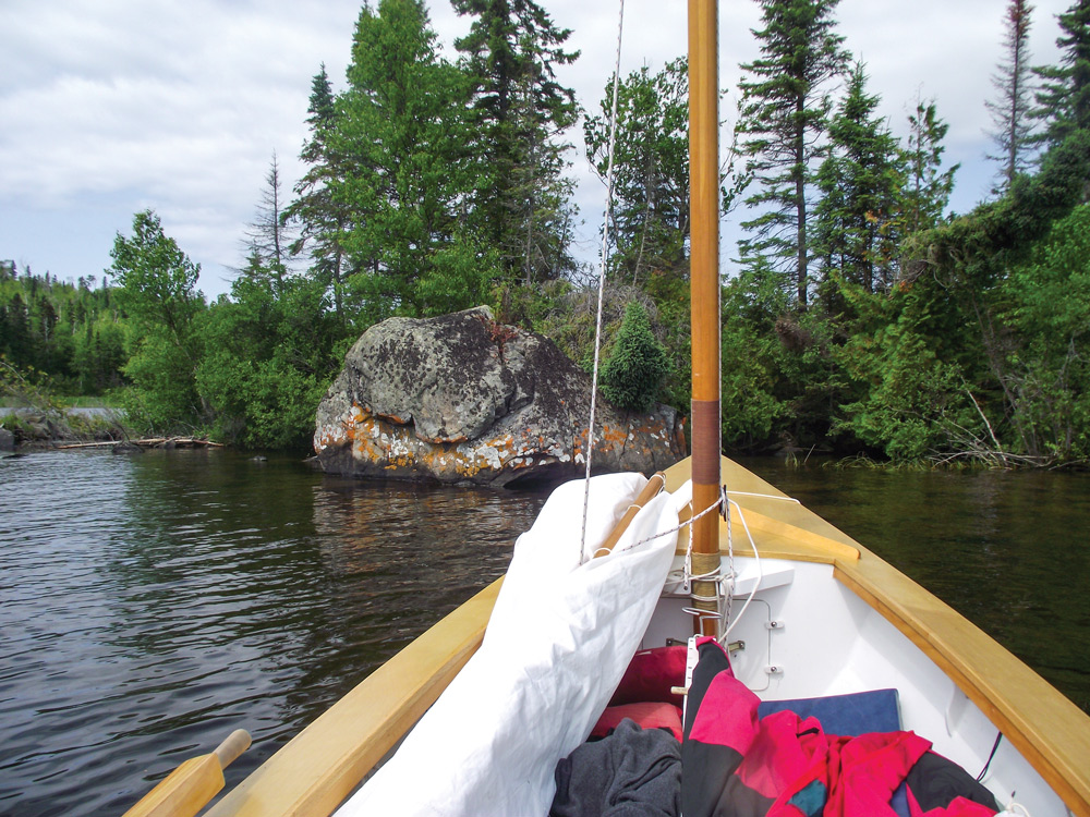
After waiting out a morning fog so thick that I couldn’t see the water beneath it, I hoisted the sail and set out just after noon. With a southerly wind, that first day was all downwind, broad reaching and running northwest past a misty forest of dark spruce and pine and scattered birch, following the edge of a jutting peninsula spiked by granite cliffs and looming headlands. The fog burned away slowly as the day went on, and the wind grew stronger. After 20 miles I dropped the sail, double-reefed by then, and worked my way into the sheltered cove at Charlie’s Harbor under oars. The surrounding shores proved inhospitable to camping ashore with, thickly wooded slopes, fallen trees, tangled brush, and boulder piles. I finally gave up, rowed into a reed bed, and dropped anchor in ankle-deep water to sleep aboard instead.
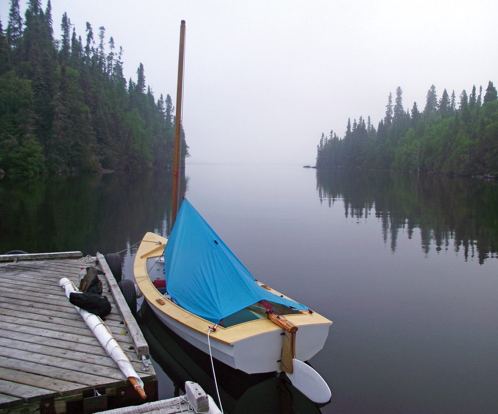
In the morning I could just make out Kelvin Island 9 or 10 miles north, a rough, low bump in the horizon that glimmered and shifted like a mirage. It seemed as good a destination as any. The life of a wise man is most of all extemporaneous, Thoreau tells us, and by this definition I am nothing if not wise. Tucking away my book—I had read a few pages of Thoreau at breakfast—I set a hand compass on the bench to steer by and swung the bow around, slipping the oars into the oarlocks and dropping into an easy rowing rhythm.
The water lay flat and calm around me as far as I could see, as if held motionless under the weight of the cloudless and immovable sky. I kept rowing slowly northward toward Kelvin Island, settling more deeply into the surrounding stillness with each moment. I might just as easily have been rowing in place while the world spun beneath me.
After four or five miles, a soft breeze swept down the lake like the slow steady breath of the world. I stowed the oars and hoisted the sail.
Checking my map, I saw that Dawson Island’s harbor lay at the very center of the lake, the hub of a vast archipelago that stretched to the farthest shores in every direction. From here, I could go anywhere. I had a vague and admittedly arbitrary notion of pushing on to 50 degrees north latitude—farther north than I had ever sailed before—and into the farthest reaches of Windigo Bay; when the next morning brought southerly winds, I didn’t waste time. After a hurried breakfast of instant oatmeal, I rowed offshore, hoisted the sail, and set off on a close reach in a faint breeze, up the east side of a chain of large islands stretching northward across the lake. I sailed for six miles along the shores of Kelvin Island, another six or seven miles past Geike Island, five more miles to pass Whiteaves Island. Island after island, broad expanses of forest that had come unmoored from the mainland to drift into my path. A scattering of tiny islets off the starboard bow—the Rabbits, according to the map—helped mark my progress through the water. Eventually I left them behind, too.
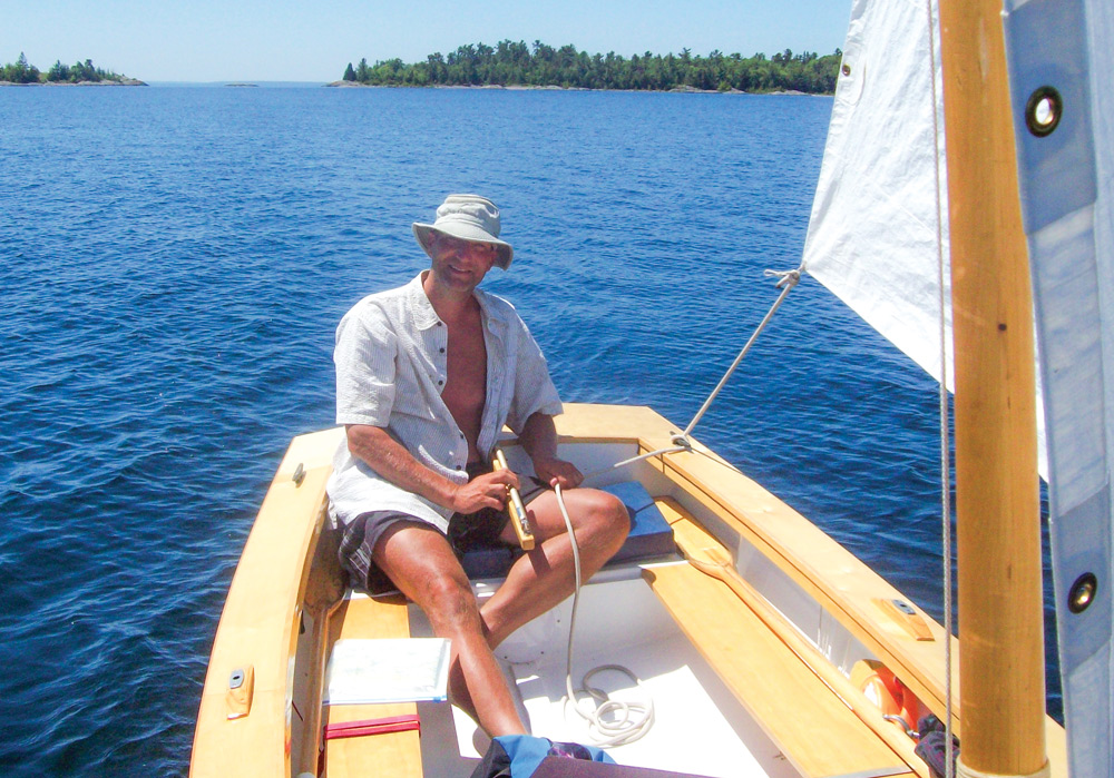
Only now, sailing along at 4 knots for hour after hour, did I begin to understand Nipigon’s immense size. My little boat was barely a speck of white in an endless maze of islands, forests, cliffs, and open waters. I hadn’t seen another boat, or another person, since leaving the boat ramp three days and 40 miles back. The sense of freedom was exhilarating, and more than a little unnerving. No one knew where I was, or where I would be tomorrow. I had no phone, and no radio—only a slightly questionable map. But the sail was a smooth curve of white overhead, pulling the boat easily through the water, rolling and swaying on the waves like a living thing. And all it would take to go here instead of there was a nudge of the tiller and a pull on the mainsheet.
The breeze faded away to almost nothing as the evening went on, but I reached Logan Island’s sheltered bay well before sunset, turning into the wind to drop the sail while the boat drifted lazily across the water. I had been aboard all day, without even a brief stop ashore. There’s no such thing as boredom when you’re sailing—not for me, anyway—but I was happy to stand, stretch, and let my attention wander. A bald eagle launched itself from a treetop and soared past overhead. Other than that, I was alone.
Just before dropping off to sleep, I pulled out the handheld GPS that my brother had insisted I bring with me. I had never used it before, and wasn’t even sure how to turn it on. But after trying enough buttons in various combinations, the screen showed my location of 50 degrees and 7 minutes north.
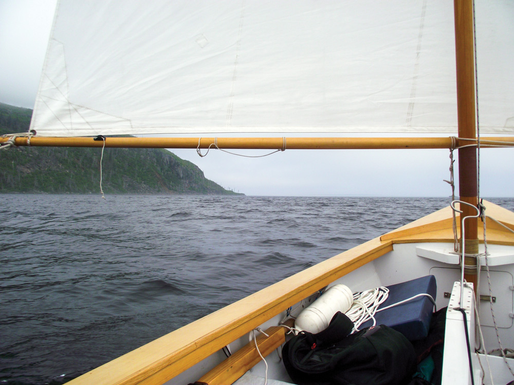
A strong northwesterly breeze was blowing by the time I pulled up the anchor and rowed out of the bay the next morning. It would be 10 miles to the head of the lake from here—10 miles dead to windward. I was tempted. The northern shores were lined with tall cliffs, and a huge mesa, flat as a tabletop, rose like a lost temple from the forest between Windigo Bay and North Bay, with broad beaches and flat marshland farther west. But with an abundance of islands to explore in every direction, the notion of a 10-mile beat into stiff headwinds seemed ludicrous. Besides, I reminded myself, I had already reached 50 degrees north. Without even a slight twinge of my conscience, I hoisted the sail and set off southward on a broad reach.
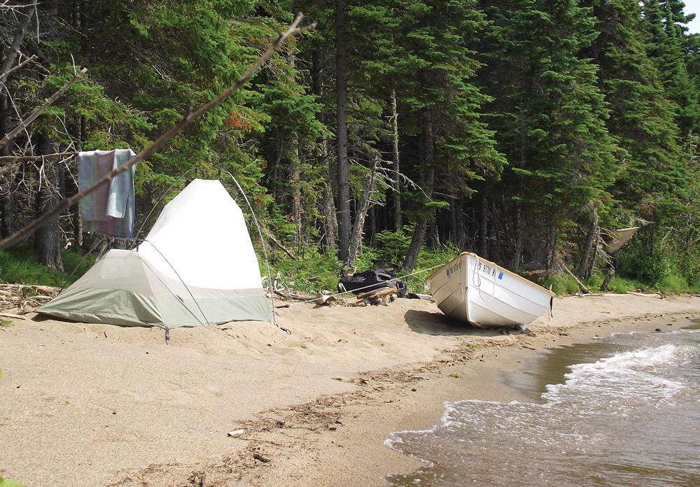
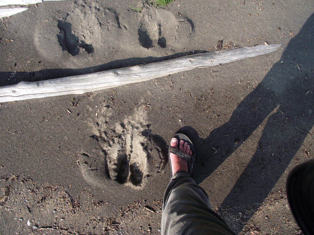
It was an easy landing on flat sand, but the beach was fully exposed—not a place to leave a boat overnight in a region of prevailing westerly winds. But that’s the beauty of a lightweight dinghy cruiser. I unloaded my gear, shoved a couple of plastic fenders under the keel to serve as rollers, and pulled the boat up onto dry sand at the edge of the forest. After rigging a few lines to hang some laundry for drying, I set up my tent in a muddle of moose tracks at the top of the beach, hoping I wouldn’t be trampled on during the night.
Nine days after I had set out from South Bay, I dragged the boat up onto a beach beside the boat ramp I had launched from and started ferrying loads of gear to my car. It was fairly windy—I finished the day with one reef tied in, and might have been better off with two—but the boat had handled far worse. Half a dozen fishing boats, though, were tied up at the docks, bouncing around and slamming against each other in the chop, a line of disappointed fishermen beside them. It was no day for them to go out. The tiny harbor, and all of South Bay, was completely exposed to the northerly breeze.
“Is that your little boat there?” one of the waiting fishermen asked me.
“My brother’s boat,” I told him. “He’s letting me borrow it.”
“Well, you don’t want to go out on a day like this,” he said, assuming I was loading gear rather than unloading it. “No one goes out on a north wind.” The way he said it, the words might have been engraved on stone tablets.
Nine days—200 miles, more or less. I had sailed through lingering blue-sky days and star-scattered nights, slipping quietly past white-whiskered otters, and owls, and red-eyed loons, through wheeling flocks of herring gulls and pelicans. I had seen eagles hanging from the sky on outstretched wings, and minnows flashing dart-like through the shallows. There had been wind and rain and storms, flashing spray and mirror-flat calms. And each moment—each delight, each small discomfort, each faint stirring of fear—had been an anchor fixing me ever more firmly to my own life, to the fleeting conjunction of here and now. That, more than anything, was what I had come looking for.
Comments